Go Aero – Air Scooter Real time spatial intelligence Automatic online 3D mapping
The obvious often misses us, unless a genius points it out. The early cars looks like horse carriages. Because it was a familiar format and use case. Cars were after all petrol powered horses. In air travel too or for that in electric vehicles – the new vehicles resembled existing cars or planes. But they didn’t have to.
Intra city electric buses have been a Rs 50,000 crore misadventure for India. They made the state transport companies more inefficient, ended up providing poor public transport and bled the govt to enrich a cartel of subsidy seeking manufacturers who sold poor quality unsafe Chinese buses suitably “India washed” to meet “made in India” subsidy conditions. To date, we niether make the battery nor the motor nor the drive electronics. The import content in the buses is supposedly more than the cost of importing a finished bus. You don’t want to repeat this in electric boats and planes.
Finally the penny clicked today.
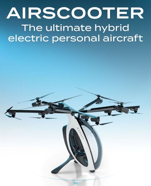
The form factor for flying is an air scooter. Easy to park. Easy to drive. The winning drive train is a serial hybrid. So electric with an onboard power generator. This reduces weight and extends range. A air scooter with a 150 km range can be delivered for rs 20 lacs delivered customer price. About the same as a Harvey Davidson bike, maybe less. It will need five litres of petrol and 20 kwh charge to travel 150 kms. And as batteries get better and lighter, you won’t need any petrol.
What’s the missing piece.
The challenge is driving these in air. How do you manage tens of thousands of these hovering above say Delhi or Mumbai. The only way to manage this is to make them autonomous and remotely piloted by an ai system. U feed the destination and ai does the rest.
To manage tens of thousands of these air scooters will need real time information in 3d of the space above the ground city wide. This is completely non trivial. You would need to fuse data from satellites, high altitude planes, ground sensors and gps data from the drones to generate a dynamic real time map with spatial intelligence. The map fails and the drones will start colliding. Killing people – not just those in the air but also on the ground.
The first Indian air scooter did test flights today. With an active payload of 150 kgs, it can carry two lightweight adults, similar to a motorcycle. It can fly at 75 kph and have a max range of 200 kms (150 kms in practice). You can also go down to a terrace for a quick five minute charge and petrol refill.
The Go Aero Scooter uses a 100% indigenous energy storage system from Go Power, Indian motors from Koteleo and an indigenous drive train from Autonymi. It also uses 100% indigenous software for both neuromorphic processing as well as telepiloting. It can transport people or goods. Or act as a drone for mapping or agri operations or even military applications.
This is it.
Ready for certification.